 ARICE Metadata Catalogue
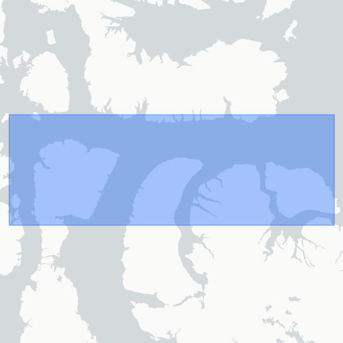
Nunavut
Type of resources
Available actions
Topics
Keywords
Contact for the resource
Provided by
Formats
status
-

This study presents sea surface concentrations of marine dimethylsulfide (DMS) measured across the Labrador Sea and the Canadian Arctic Archipelago during summer of 2017 (July-August). Using a novel automated instrument (ACT-MIMS) more than 2500 DMS observations were collected at high frequency alongside ancillary measurements of salinity, temperature, fluorescence (chlorophyll a proxy), solar radiation, ice concentration and the algal precursor of DMS, dimethylsulfoniopropionate. DMS concentrations ranged from ca. 1 to 32 nmol L-1 (average of 6 nmol L-1) in 2017 over an area covering a wide range of contrasting marine environments from coastal to open ocean, ice-free waters, as well as under-ice waters. Surface water DMS hotspots were measured in association with thermohaline oceanographic features in high productivity coastal waters, as well as with the presence of ponded first-year ice (FYI). Nighttime increases and daytime decreases of DMS concentrations were also observed in productive areas of the Labrador Sea and Davis Strait continental shelf. The association of DMS concentrations with diurnal solar radiation variation suggests the involvement of photobiological processes. Overall, our results strengthen the view that aqueous DMS cycling in the Arctic is intimately linked with sea ice dynamics and physiological responses to light. As such, future changes in the seasonality of the Arctic cryosphere will likely play an important role in shaping DMS emissions, although the sign and magnitude of the change remain highly uncertain.
-
Onshore research was conducted using the following methods: multi-temporal analysis and mapping of modern and raised coastal systems using airphotos, satellite imagery, LiDAR and RTK surveys. Data on the sediment composition of coastal landforms was collected using graded photographs. Shallow-water mapping of transgressive coastal systems was carried out using multibeam sonar and sub-bottom profiler primarily from the CCGS Amundsen and the CSL Heron during the 2006 ArcticNet NCE scientific cruise.
-

Onshore research was conducted using the following methods: multi-temporal analysis and mapping of modern and raised coastal systems using airphotos, satellite imagery, LiDAR and RTK GPS surveys. Data on the sediment composition of coastal landforms was collected using graded photographs and in situ measurments of gravel samples. Shallow-water mapping of transgressive coastal systems was carried out using multibeam sonar and sub-bottom profiler primarily from the CCGS Amundsen (EM300 30 kHz) and the CSL Heron (EM3002 3.5 kHz) during the 2006 ArcticNet NCE scientific cruise and from the CCGS Henry Larsen and the CSL Heron in 2008.
-

Air, water (grab and passive) and sediment samples were collected from on board the CCGS Amundsen in the summer of 2015 as a part of ArcticNet and the Northern Contaminants Program. These samples were collected to determine the occurrence and levels of legacy pesticides and new and emerging priority compounds under the Canadian Chemical Management Plan.
-

To obtain the data, water samples of vertical profiles were firstly collected from the Rosette onboard the CCGS Amundsen, and then analyzed with instruments both onboard and in the lab in University of Manitoba. The total mercury were measured on a Tekran 2600 Model with the method EPA 1631 in the Portable In-situ Laboratory for Mercury Species onboard, while the methylmercury data were analyzed with the method EPA 1630 in the Ultra-Clean Trace Element Laboratory, which is located at the University of Manitoba. The main data types are the contaminants (along with O18 isotopes and dissolved organic carbon) concentrations in vertical profiles at the study sites.
-

In 2017 and 2018, we sampled about 20 locations across Frobisher Bay, mostly in the deeper portions of outer Frobisher Bay that are only accessible for sampling from large ships. Sample stations were chosen to span the range of depth and slope values in the multibeam sonar dataset, and in 2018 sampling, also included gross bottom morphology, such as ridges and troughs. We also targeted some particular geomorphic features, such as suspected submarine extensions of moraines. In 2017, bottom samples were acquired using box-cores, and small scientific trawl (Agassiz trawl). In 2018, bottom samples were acquired using box-cores, combined with a drop-video camera. Agassiz trawls were collected at two stations in 2018. Sediment samples were described visually and subsamples frozen for grain size and organic content analysis. Where informative, subsamples of lithic fragments within the sediments were kept for mapping. Bottom faunal samples were enumerated and preserved in 2% formalin in seawater, except for larger faunal samples such as soft corals, which were frozen.
-

The surface temperature of the target within the passive microwave (PMW) systems field of view were collected on a high temporal resolution. An infrared transducer was positioned on the port side of the CCGS Amundsen, at a height of approximately 7 meters. Data collection occurred every 15 seconds. The instrument collected data throughout the entirety of the Amundsen Cruise at a fixed angle. Brightness temperature data of target is in degrees Celsius.
-

Two video surveys were conducted in July 2016 at Disko Fan (South East Baffin Bay, Nunavut, Canada) using a Super Mohawk remotely operated vehicle (ROV) aboard CCGS Amundsen. The benthic environment was video-recorded and photographed using a high-definition camera (1Cam Alpha, Sub C Imaging, 24.1 megapixels), at a depth range of 888-941 m. Sites suitable for the deployment of box-cores and piston-cores were identified from the videos during the first survey, samples of corals, sponges and a zoanthid were collected (N= 13), and a video transect was conducted. Sea water was collected at several depth intervals from surface to near-bottom to determine calcium carbonate saturation.
-

A data collection program was carried out between October 2015 and September 2017 to monitor the thinning and overall deterioration of "Petermann Ice Island (PII)-A-1-f". This large, tabular iceberg was a fragment of the 2012 Petermann Glacier calving event. Four field teams visited the ice island, and a stationary ice penetrating radar (sIPR) was installed on PII-A-1-f in October 2015 while the large, tabular iceberg was grounded near Qikiqtarjuaq, NU. The instrument was designed by Blue Systems Integration, Ltd. and was installed during the annual ArcticNet research cruise on board the CCGS Amundsen. It collected the first field dataset of ice island thinning, and along with surface ablation observations, the data were used to calibrate a forced-convection basal ablation model. Mobile IPR data were repeatedly collected over 2.4 km to assess the spatial variation in thinning and assess how well the sIPR measurements represented the conditions elsewhere on the ice island. Auxiliary data included photos, ablation stake measurements, sonic ranger recordings, air temperature measurements, GPS locations, and RADARSAT-2 synthetic aperture radar (SAR) imagery. The latter were collected to monitor the surface areal extent of the ice island. The dataset contains: IPR measurements (.h5), GPS data collected along the mIPR transect (.csv), image files of ablation stakes (.jpg), air temperature data, sonic ranger measurements, and GPS positions of the weather station (.csv), georeferenced Fine-Quad (8 m nominal resolution) RADARSAT-2 SAR images (.tif) and polygon shapefiles delineating the areal extent (.shp).
-

Coral samples were collected in Pond Inlet and Lancaster Sound in Baffin Bay using the CCGS Amundsen’s remotely operated vehicle (ROV). Samples from Agassiz trawl and box-core deployments were also kept as part of this study (11 stations). Samples were collected between 253 and 856 m. Specimens were subsampled aboard and frozen for determination of their carbon and nitrogen stable isotopic composition, as well as for lipids and fatty acids composition, as part of a study focusing on the trophic ecology of cold-water corals. Carbon and Nitrogen stable isotope analysis as well as lipids/fatty acids analysis were performed on tissue samples of soft corals at the Stable Isotopes Laboratory and Lipids Laboratory, Memorial University, respectively.